Uluru - Ayers Rock - Part 2 Sept 20 - 22
Tues. Sept.20 - Day 5
Left Alice Springs this morning and drove through 'trusts', which are like native reservations back home. The kangaroo signs were now camel signs, as there are over 1 million wild camels in this part of Australia. We were heading west on the Lassester Hwy just north of South Australia. We saw a goanna crossing the road and strange tennis ball size fruit growing along the ground on vines on the side of the road. We later found out these were gourds.
 |
| More Australian road signs |
The landscape reminded us of Drumheller. We stopped at Mt. Ebenezer and fuel was $2.50/litre, yikes!! Back on the road and we could see Mt. Connor, some people are tricked into thinking it's Uluru, but I was warned ahead of time.
 |
| Mt Connor, NOT Uluru |
 |
| Red Center Way |
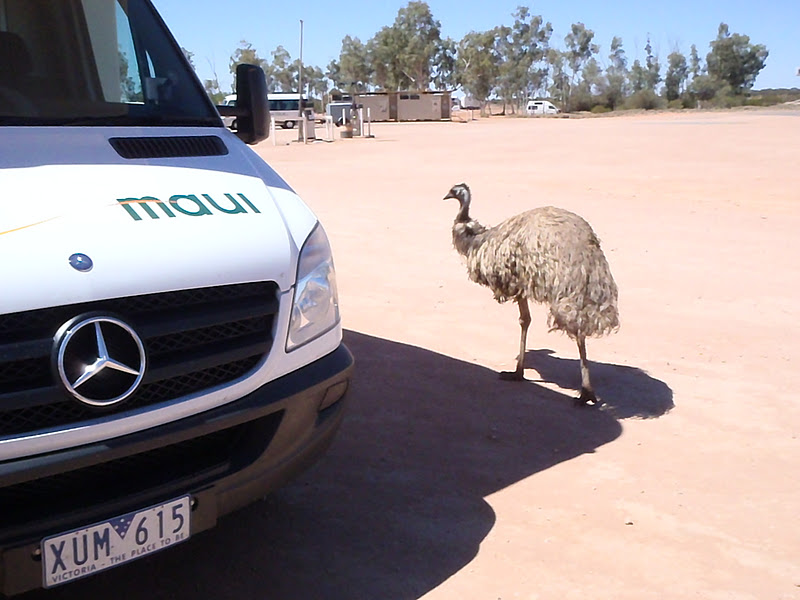
Stopped at Curtain Springs to make lunch and had a visit from an emu.
 |
| You'll be supper tomorrow night! |
 |
| look out behind you! |
Arrived in Yulara, which is the town/resort just outside Uluru - Kata Tjuta National Park, at 2:30. Checked in at our campsite and then headed to the camel tours for a short camel ride. Scott was on Barney, Hailey & I were on Apollo and Brody was on Johnny. For some reason none of us could remember Darby's camel's name. We learnt that it is illegal to use a bit in the mouth of "the ship of the desert", like we do with horses. They could choke to death, due to the fact that they constantly regurgitate their food.
 |
| Giddy Up! |
 |
| Ship of the Desert, follow the leader |
 |
| Camel nose piece |
 |
| Everyone is smiling, even Darby's camel |
After heading back to camp for a snack, we then got picked up at 5:40 to take us to the airport for our sunset helicopter tour. This was a first time in a helicopter for Darby & Hailey, so Darby sat up front for our 30 minute flight. We flew to Kata Tjuta (Olgas) first, then back around to Uluru. Kata Tjuta means many heads, as it has 36 separate round peaks and domes. The tallest one is 200m higher than Uluru. Uluru rises 348 m and has a girth of 9.4 km. Two thirds of the weathered rock lies beneath the surface. The flight was excellent and a great way to see Uluru changing colours as the sun set.
 |
| Ready for take off |
 |
| What big rock? |
 |
| Uluru ( Ayers Rock) |
 |
| Kata Tjuta (The Olgas) |
 |
| I see it! The red rock! |
 |
| Best seat in the house |
 |
| great birthday gift |
A great end to a very full day.
Wed. Sept 21 - Day 6
Up VERY early to watch the sun rise and the way the light plays with the colours of Uluru. We watched Uluru go from a greyish brown to an orange and then red. We couldn't believe how cold the red desert sand was this morning, compared to the burning heat of the sand during the day.
 |
| keeping warm in the cool morning desert |
 |
| breathtaking |
 |
| beautiful sunrise |
 |
| view from our lookout at our campsite |
It was well worth the early start to the day, but we all crawled back into bed for a little more sleep before our next activity.
We headed into the National Park to hike and explore Uluru on the ground. The Uluru base walk is 10.6 km for a full circuit. We did the Mala Walk to Kantju Gorge, which is 2 km return and the Kuniya walk to Mutitjulu Waterhole, which is 1 km return. We decided to do these trails instead of climbing Uluru, respecting the Tjukurpa & Anangu wishes. This also allowed us to follow the footsteps of ancestral beings that shaped the landscape. Some of the areas we walked were sensitive and sacred and thus we couldn't take photos in this section. The sheer vertical walls were enormous and there were many areas where the first Mala people camped and cooked at Uluru. The profound peacefulness of Kantju Gorge had us sitting and listening to the sounds in this area. The legend says this is the home of Wanampi, an ancestral watersnake.
 |
| Shelter where the elders waited |
 |
| Amazing looking rock formations |
 |
| Anangu rock art |
 |
| Mutitjulu Waterhole |
 |
| listening & watching the bird life at the waterhole |
After exploring Uluru, we drove over to the Kata Tjuta to hike & explore 'The Valley of the Winds'. We did the grade 3 moderate 2.2 km hike to Karu Lookout. The rock formations here were very different to Uluru. Uluru is more porous, like Swiss cheese with large slabs that slide off. Kata Tjuta are more rounded boulders & rocks. There aren't any stories or legends for this rock, as this is a sacred, "Place of Great Respect".
We drove back to the resort campground and went for a swim in the pool. After we changed we caught the shuttle bus to the Outback Pioneer Hotel & Lodge for supper. It was a buffet so everyone was trying something new tonight. We had grilled or smoked kangaroo, barramundai, sushi, oysters, mussels and much more. Sushi was the big favorite tonight.
Took the shuttle to the supermarket to pick up a few items and then back to our camper van for the night.
 |
| dessert time |
Thurs. Sept 22 - Day 7
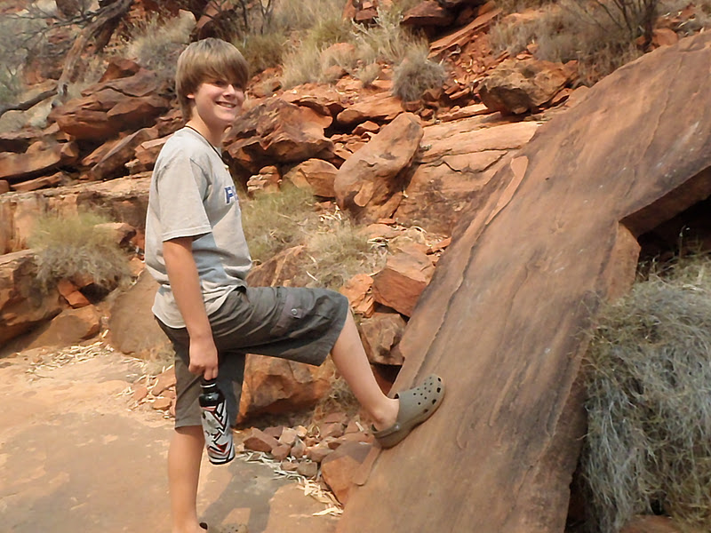
After some souvenir shopping this morning we left Uluru to continue our adventure to Kings Canyon. It was a smoky, hazy morning as we turned onto Luritja Rd shortly after 11 am. We were hiking the Kings Creek at the bottom of the canyon by 1 pm. This was an interesting hike of the canyon floor.
 |
| Kings Creek canyon |
 |
| top of canyon wall |
 |
| cool layers- so different from Uluru |
 |
| long way up |
We left by 3:00 only to be stopped as the road was closed due to bush fires. We ended up having to wait 2 & a half hours, as this was the only road out. Scott read a magazine, the kids watched Crocodile Dundee III, I read, wrote postcards and made chili for supper later.
 |
| Fires held us up |
 |
| Waiting for the road to open |
7:30 we finally got to the T intersection of the Lasseter Hwy, it was dark but we kept on driving to the nearest caravan park. We got to see some interesting wildlife, an owl, lots of mice running across the road and even a bandicoot.
8:45 pulled into Erldunda and got a site for the night. We went straight to bed after a long day.


AMAZING!!!! Wow, what a sight!!! I am SO glad you did this trip!!!! AND CAMELS....how fun!!!! Can't wait for part 3!!!
ReplyDeleteLove Tina